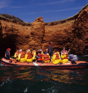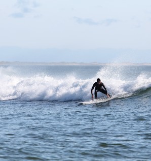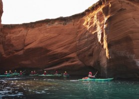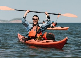

Kayaking is without a doubt a privileged way to explore the rugged coast and admire the red sandstone cliffs shaped by the force of the wind, ocean and time. Several tourism operators offer packages with a guide and interpreter allowing you to discover wonderful sites otherwise inaccessible. For any open-sea excursion, it is highly recommended you hire an experienced guide. If you prefer to experience this activity on your own, consult Les Îles de la Madeleine Water Trail Maps. Most importantly, prepare a float plan and leave it with a trustworthy person or file it with the Coast Guard before you set off.
Les Îles de la Madeleine offer a wealth of unique sites for enjoyable kayak trips.
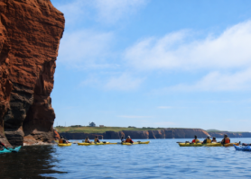
The geography of the archipelago creates a mosaic of routes that will delight both amateur and expert paddlers.
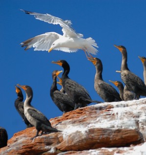
Birding, beachcombing, exploring sheltered inlets, visiting coastline tourist attractions and fishing harbours are just a few of the activities paddlers can enjoy.
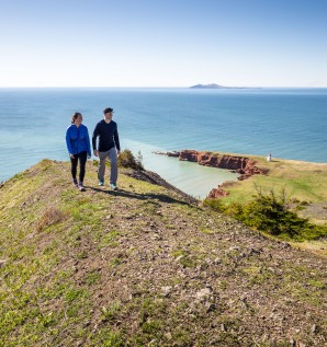
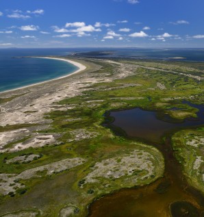
Without a doubt, sea kayaking is a great way to explore — at sea level — various environments which characterize the archipelago: vast interior lagoons, geologically diverse cliff formations (red sandstone, limestone, schist, alabaster) beaches and dunes that disappear into the far horizon.


- Nathalie Bourgeois, L'Étang-du-Nord
- Sylvain Bélanger, Sainte-Thérèse
![]() Les Îles de la Madeleine Water Trail is an unmarked waterway accessible to small, shallow-draft craft, such as sea kayaks. From island to island, paddlers can follow the Water Trail depending on the velocity and direction of the winds that dictate daily route planning. The Water Trail maps include nearly 30 launch sites, 8 suggested itineraries with information on navigation, distances between launch sites, specific local conditions and services available to travellers along the suggested routes. Itineraries are classified in four levels of difficulty, from easy to very demanding. Remember! Weather conditions (which are extremely variable) are not considered when establishing these levels. Download the Water Trail maps below.
Les Îles de la Madeleine Water Trail is an unmarked waterway accessible to small, shallow-draft craft, such as sea kayaks. From island to island, paddlers can follow the Water Trail depending on the velocity and direction of the winds that dictate daily route planning. The Water Trail maps include nearly 30 launch sites, 8 suggested itineraries with information on navigation, distances between launch sites, specific local conditions and services available to travellers along the suggested routes. Itineraries are classified in four levels of difficulty, from easy to very demanding. Remember! Weather conditions (which are extremely variable) are not considered when establishing these levels. Download the Water Trail maps below.

Plage de l'Ouest (West) Beach (HA1) - Anse du Bassin (HA4)
Distance: 13.6 km
Level: Moderate - Demanding
The cliffs along the south shore of Havre Aubert Island are breathtakingly beautiful. The Gros Cap ("Cap de la Roche") shelters a variety of bird species, much to the delight of bird watchers. Itinerary relatively sheltered from north winds.
Note: To access the site at Plage de l'Ouest Beach (HA1), launch your craft directly off the beach at the end of the Chemin de la Dune de l'Ouest. Use marked parking area along the road. At Anse-à-la-Cabane (HA2), parking is permitted in the winter boat storage area. At the Chemin du Moulin lauching site (HA3), daytime parking is permitted along the public road.
Plage du Cap (Cape) Beach (HA7) - Les Plaisanciers du Havre Marina (HA6)
Distance: 7.2 km
Level: Easy
Steeply-rounded cliffs of red, green and gray clay, basalt, gypsum and alabaster, Les Demoiselles are one of the geomorphological and geological jewels of the archipelago. Seen from the water, they offer a spectacular sight. Choose the historical site of La Grave as your starting or arrival point. It is the ideal spot to just stroll along and enjoy the relaxed, convivial atmosphere. Itinerary relatively well protected from southwest winds.
Note: To launch your craft on Plage du Havre Beach (Sandy Hook) (HA5) there is a 130 m (430 ft) portage trail, and a 90 m (300 ft) portage trail at Plage du Cap Beach (HA7). Parking at Plaisanciers du Havre Marina is reserved for members. However, you will find a boat launch, public restrooms and showers, drinking water and restaurants nearby.
BEWARE!
On the southwest side of Havre Aubert Island when winds are northeasterly: Cross-sea and breaking waves. Sea may become very confused.
At La Passe (area between end of the Bout du Banc and Entry Island), when winds are southerly and southeasterly: breaking seas, especially at ebb tide. Presence of shoals (breaking waves).
 Map 1 - Havre Aubert Island
(350 Ko)

Parc du Gros-Cap (CAM6) - South Bay (CAM8)
Distance: 11 km
Level: Moderate
This astounding rocky prominence has earned its reputation! Gros Cap's network of tunnels and grottoes is a perfect example of the incessant, relentless assault of the sea on the land.
Note: Very busy during the tourist peak season. At Parc du Gros-Cap (CAM6), free parking for members inside the park, near the launch area. At Des Ramées Beach (behind the building of Sureté du Québec) (CAM7), direct access to the Coastal Trail, a paved 2 km biking and hiking trail.
BEWARE!
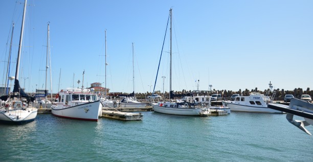
There is a lot of commercial traffic in the port at Cap-aux-Meules. Always be very careful when approaching the dock. Several ferry and excursion boats operate in the port.

Plage de l'Hôpital Beach (CAM1) - L'Étang-du-Nord Cove - Site de La Côte (CAM3)
Distance: 11.5 km
Level: Demanding
Go on a discovery trip and explore this unique coastal environment with its succession of hollowed-out cliffs, caves, stone columns and arches rising out of the sea. Itinerary relatively sheltered from SE, E and NE winds.
Note: Daytime parking permitted along the public road at Chemin Delaney (CAM4).
BEWARE!
As the summer progresses, the northwesterly wind will produce higher seas along the north shore because of the fetch and the wind's strength. There is no place to take shelter or land between Cap aux Maquereaux and the Chemin du Phare (CAM2). Beware of the surf.

Wharf at Cap-Vert (CAM10) - Launch beside the Club nautique du chenal (HAM1)
Level: Easy - Moderate
A wise choice when strong winds are blowing. A tour in this area will give paddlers rapid access to distinctive panoramas and richly-populated habitats.
Note: The launching ramp in the marina (Club nautique du chenal) (HAM1) is reserved for members. Around aquaculture sites, keep an eye out for surface buoys used to support farming structures in the lagoon at Havre-aux-Maisons.
Launch beside the Club nautique du chenal (HAM1) - Roadside stop at la Dune-du-Sud (HAM4)
Distance: 10.9 km
Level: Moderate
Discover the beauties of this sector and explore a unique geological environment composed of majestic red and gray sandstone cliffs, mud slides and gently sloping hills.
Map 4 - Havre aux Maisons and Pointe aux Loups Islands
(420 Ko)

Grosse-Île Harbour (GI1) - Grande Échouerie (Old Harry) Beach (GI2)
Distance: 20 km
Level: Very demanding
If you are looking for wide open spaces, paddle along this fine sandy beach in what can only be called a lyrical environment.
Note: Use the parking at Old Harry Beach (GI2). You will find public restrooms and showers and drinking water. To launch your craft, there is a 220 m (720 ft) portage. Boat ramp available at Grosse-Île harbour (GI1).
BEWARE!
When winds blow from the northeast: breaking waves due to numerous reefs and shoals. Navigation can be extremely difficult.
When the wind blows from the northwest, the north and the northeast with an ebbing tide: breaking waves due to numerous reefs and shoals. High, breaking waves off the East Point where currents from either side meet at the tip of the point.
Map 5 - Grosse Île Island
(376 Ko)

Grande Échouerie (Old Harry) Beach (GI2) - Port of Grande-Entrée (GE4)
Distance: 13.1 km
Level: Moderate
Get a close look at the natural caves in the cliffs near Old Harry and paddle along the shore of Île Boudreau in the lovely Bassin-aux-Huîtres until you come to the archipelago's largest commercial fishing port.
Note: Use the parking at Old Harry Beach (GI2). You will find public restrooms and showers and drinking water. To launch your craft, there is a 220 m (720 ft) portage. At Chemin du Bassin access point (GE1), there is a 105 m (345 ft) portage.
BEWARE!
Keep an eye out for commercial traffic around the port at Grande-Entrée (GE4) and along the channel used by the salt mine.
Map 6 - Grande Entrée Island
(422 Ko)
3 results