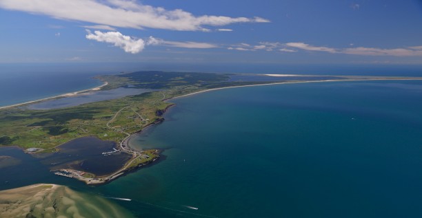
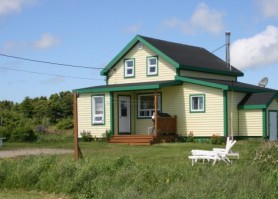
The island of Cap aux Meules is the gateway to the archipelago. The island may look more "urbanised", but nature is never far away. A majority of the population of Les Îles lives in its three villages (Cap-aux-Meules, L'Étang-du-Nord and Fatima) and the island is the service and administrative centre for the archipelago.
On your arrival at the port, you will be charmed.
The name, Cap-aux-Meules (Grindstone), comes from the presence of grindstone in the hill
overlooking the port. Cap-aux-Meules is the ferry's point of arrival, where visitors get their first look at the Madelinot countryside.
Cap aux Meules Island, the second largest island in the archipelago (after Havre Aubert Island), has the largest population and is the Islands' services and administrative centre. Here we find the Hospital, the Regional High School, the Cégep de la Gaspésie et des Îles, the Hydro-Québec power plant and a wide variety of businesses and stores. The three districts that form the Island, Cap-aux-Meules, L'Étang-du-Nord, and Fatima, invite visitors to explore an island with lovely countryside, activities and attractions for everyone.


 Fatima, the newest village on the Îles de la Madeleine, includes the townships of Cap-Vert, Grand-Ruisseau, l'Hôpital and Les Caps.
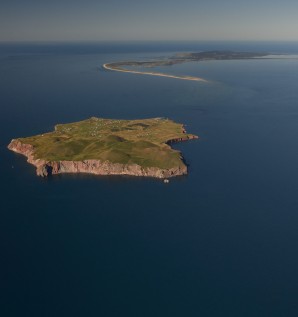
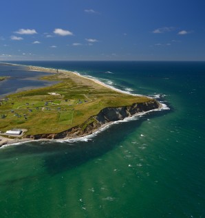
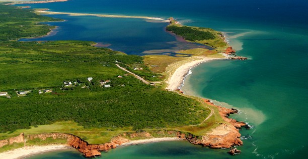
Exposed to northerly winds, the coast is indented by spectacularly steep, jagged cliffs.
The long, flat Dune du Nord Beach (north dune) was used as a landing strip for the first airplanes arriving on the archipelago until 1959.
Belle Anse (pretty cove) offers a striking example of cliffs sculptured by the sea.
 For the last fifty years, the concentration of businesses and services has made Cap-aux-Meules, with its main street, village-like appearance, numerous restaurants, bars and other facilities, the centre of the Islands.
Despite the "urban" look of Cap-aux-Meules, nature is never very far away. A walk in Parc des Buck, at the end of the Chemin de la Mine will reveal spectacular views of the Island and its neighbours.
You might also choose to walk the coast path (Sentier du Littoral) where pedestrians and cyclists share 2 kilometres of trail leading to the lookout at the top of the cape. From the Chemin du Quai you can reach stairs leading to a scenic lookout at the summit of the hill.
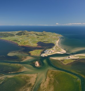
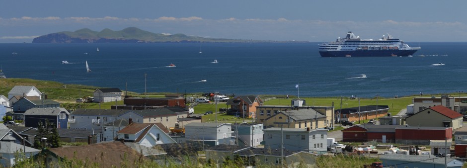
The port of Cap-aux-Meules bustles with activities: offshore and coastal fishing, the arrival and departure site for boats crossing to the mainland (Souris, Montréal) and the ferry boat to Entry Island. Sailing enthusiasts visiting the archipelago will find a well-equipped marina. Close to the harbour, boats in dry-dock await the next fishing season or undergo repairs. An enormous travel lift crane with long straps is used to handle boats.
Tourisme Îles de la Madeleine and its tourist information bureau welcome visitors on arrival, year round. Our friendly and attentive staff will answer all your questions and provide information on various services, tourism activities, weather, accommodations, restaurant menus, events. Two computer stations with Internet access are also available during opening hours.
 L'Étang-du-Nord is located to the west of Cap-aux-Meules. It is formed of several townships, each of which has its own personality.
The scenic road along the Chemin de Gros-Cap overlooks Baie de Plaisance (pleasant bay). One kilometre further on, explore the cliffs and caves that are the distinctive feature of Parc de Gros-Cap.
On returning to Route 199, don't miss the beautiful white La Vernière wooden church. It is one of the largest wooden churches still existing in North America today.
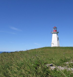
Farther along, the Site de La Côte is a public park where the Madelinots like to stroll around L'Étang-du-Nord fishing harbour. The focal point of the area around the cove at L'Étang-du-Nord is a magnificent sculpture. From the end of Chemin Delaney, you can see Île aux Goélands (Gull Island), an excellent site for bird-watching. It is possible to walk along the coastal cliffs to Hérissé Cape, and L'Étang-du-Nord lighthouse (Chemin du Phare), where a peaceful view awaits you, particularly at the end of the day when the contours of the landscape glow in the slanting beams of the setting sun.
222 results


 (Add to favorites)
 (Add to favorites)
 (Add to favorites)
 (Add to favorites)
 (Add to favorites)
 (Add to favorites)
 (Add to favorites)
 (Add to favorites)
 (Add to favorites)